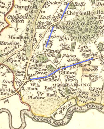
. > ...
the history of Leyton and Leytonstone
from . dot to … dots – with plenty of spaces

The Romano-British period
Roads continued

Sections of a Roman road have been identified running from Great Dunmow to Chigwell (the High Road). A continuation of the route from Chigwell to Wanstead is suspected 1 (which would involve crossing the River Roding by what is now the private Roding Hospital). John Shepherd speculates that another Roman road from Chelmsford / Caesaromagus joined the Dunmow / Durolitum road on the east side of the crossing, which may then have been affected by the tides 2.
The suspected Roman road along or parallel with the ‘Walthamstow Slip’ might have met the known Roman road at ‘Egg Clump’, Claybury by crossing the Roding at what is now Charlie Brown’s roundabout. Or it may have changed direction at what is now Eagle Pond and joined an extension of Leytonstone High Road to connect with the Dunmow Road. The line of Elmcroft Avenue E11 would fit that possibility. (Another Roman road is suggested running south-west from the crossing of the River Roding, crossing modern Nutter Lane and George Green to reach Cann Hall Farm 3.)